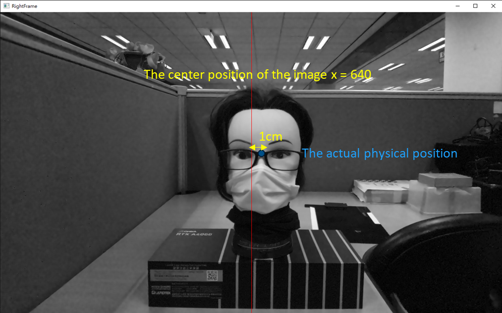
To accurately measure the error of world coordinates, we utilize a plotter and a rangefinder for data measurement.
After several algorithmic measurements, anomalies were detected.
The primary reason is that the center of the image appears to be inconsistent with the physical center of placement.
At a distance of Z = 50cm from the test object to the camera, there is a 1cm error in the X-axis.
Simply put, if an object is placed at the 0-degree position, there is a 1cm offset in the captured image. Is this reasonable?
